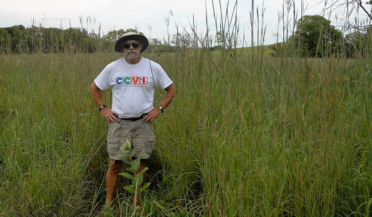
A Vision of Accessibility

Though he had retired after several decades of teaching the blind and visually impaired, Craig L. Phillips (Ohio State University, 1972) jumped at the chance to get back to work when a cutting-edge project he’d started years ago, finally had a chance to come to fruition.
As a result, Phillips helped make the Tallgrass Prairie National Preserve in Strong City, Kansas, accessible for visitors who are blind or visually impaired. The September 2016 launch marks the first time GPS technology has been used to improve accessibility in a National Park.
Phillips originally taught English and Braille at the Kansas School for the Blind. Then he went to the University of Northern Colorado to become a certified orientation and mobility specialist. He learned to teach people who are blind how to determine where they are in a space, how to orient and how to travel safely and efficiently through a space.
When the park service contacted the Kansas School for the Blind and asked how they could make the Tall Grass Prairie accessible, the call was routed to Phillips. Years earlier Phillips had taken an interest in GPS technology after reading about Doug Baldwin at Saginaw State University. “He talked about creating environments much like Hansel and Gretel using electronic data instead of bread crumbs,” Philips said. “That really captured my imagination because to me that was a Brave New World/Buck Rogers type of thing.”
In 2002 Phillips attended an international conference and became further intrigued. There he walked through Toronto with a blind man and his dog as the man pointed out landmarks. He didn’t see them, but the GPS device from Sendero Corporation told him they were there. “That was so exciting because it was the first of its kind,” Phillips said.
Phillips then worked to bring GPS technology applications to Shawnee Mission School District in Kansas City. “I morphed through the different devices and improvements but couldn’t find any information on how you teach this. I was flying by the seat of my pants. Nothing had been written,” he said.
Phillips published an article in 2011 in the Journal of Visual Impairment and Blindness about his experiences teaching GPS to the blind and visually impaired traveler. The article was well received and Phillips came to be considered an expert on how to take GPS technology and use it in lessons to teach the blind and visually impaired.
Unfortunately, an initial proposal to bring this technology to the National Park Service was turned down. “I’m sure that whoever received it laughed uncontrollably,” Phillips said. Then in the fall 2015, a revised proposal linked to the 100th anniversary of the National Park Service was accepted.
That’s when Phillips dove in headfirst working to mark the trails, record routes, define landmarks and place electronic waypoints using a GPS device designed for use by travelers with visual impairments. The device automatically provides auditory information that relates to the traveler’s location and position in real time, as well as recorded anecdotal commentary about the flora, fauna, history, wildlife, and other pertinent information about the geographic position in the environment.
Sublime beauty is how Phillips describes the 11,000-acre prairie, which includes 40 miles of trails. “The rolling hills and fields of grass that’s the Tall Grass Prairie. It is just utterly beautiful. Then in one pasture, there is a herd of bison.”
The device informs the traveler of the surroundings, alerts the traveler of the impending danger of traveling through this area, describes the bison’s history, diet and behavior, and provides the user with the sound of a bison for familiarity. The visitor center has purchased four of the devices, which are available to all travelers in the park.
“To get to the end of a project and see the finished work and know that it’s going to be viable is pretty exciting. Knowing how many people could access, use it and gain from experience, which was pretty neat,” Phillips said.
